From a single site visit, we deliver accurate deliverables, at speed
View, analyse and share guaranteed accurate spatial data with your verified Measured Building Survey.
Included in our Measured Building Survey package
At the heart of every project is verified point cloud data, providing a single source of truth for all deliverables, from RICS compliant (NIA, GIA & IPMS) measurement reports to 2D CAD, 3D models, digital twins, and compliance-ready outputs. With insurance-backed deliverables, we give stakeholders complete confidence in every decision.
Verified. Visual. RICS-Compliant.
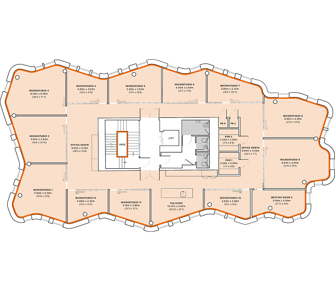
Verified floor plans
Accurate floor plans verified against site data, giving you accurate measurements (GIA, NIA, IPMS) for confident planning, valuations, and compliance decisions.

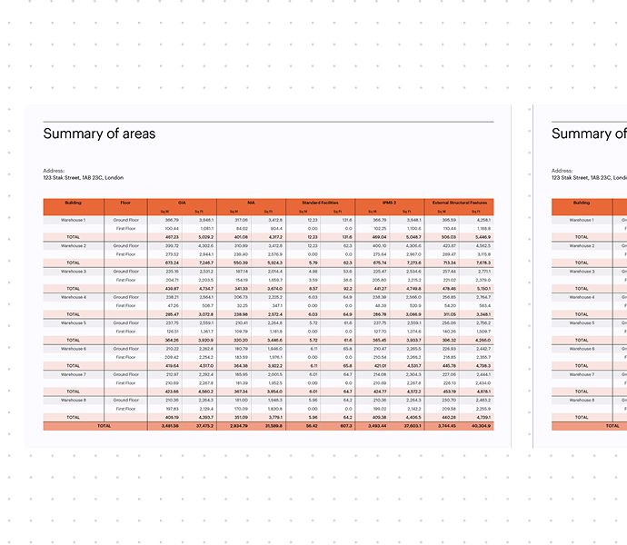
Summary of areas report
A clear breakdown of areas and measurements, saving time for design teams and project managers who need instant insight into space allocation and compliance.
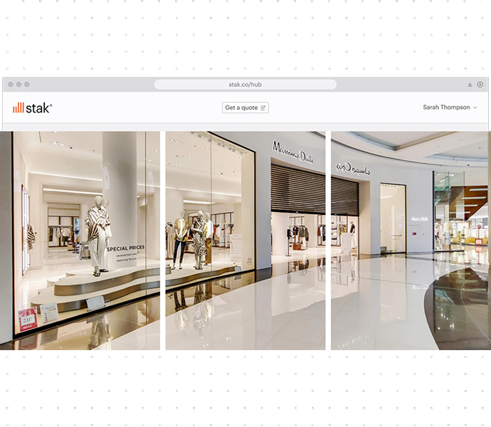
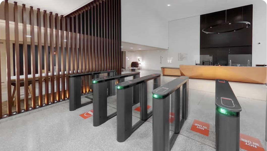
Professional photography
High-resolution imagery that documents every property’s condition with precision, supporting valuations, insurance, and legal evidence with verified visual records.
Optional extras
360° virtual tour
Enable remote viewings as well as mid-term inspections and current building condition updates.

Letter of reliance
A formal assurance document that certifies measurement accuracy and data integrity, providing legal confidence to lenders, insurers, and project stakeholders.
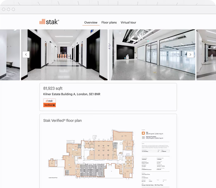
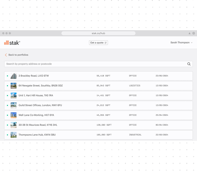
Through Stak Hub, explore and manage
your spatial data effortlessly.
Stak Hub brings all your verified spatial data together in one secure, intuitive platform. Access floor plans, CAD, BIM, photography and digital twins instantly — all produced through DRC’s proprietary technology. With every asset structured, standardised and easy to navigate, you gain complete visibility and control across your portfolio.
Why it matters
Confidence in accuracy
Every survey follows strict RICS guidelines, ensuring you work from reliable data.
Smarter decisions
Verified assets streamline everything from property management to leasing and renovations.
Market-ready visuals
Showcase your property with professional photos and immersive tours that engage tenants, buyers, and investors.
View, analyse and share guaranteed accurate spatial data with our Measured Building Survey

Architects and Project Managers
Providing precise, foundational data for accurate design and planning, reducing errors and costs.

Property Owners
See where space can be optimised, and act on what matters.

Developers
Build with confidence, from planning to final sign-off.

Asset and Property Managers
Everything needed to market, lease, and manage portfolios with confidence.

Facilities Managers
Stay ahead of safety, compliance and efficiency challenges.
Billions of buildings.
No digital standard.
We bring accuracy,
consistency, and clarity
to the built world.
No digital standard.
We bring accuracy,
consistency, and clarity
to the built world.
We've digitised 180,000+ spaces, totaling
390+ million square feet