Reduce risk and improve efficiency across the life cycle of an industrial or logistics asset
Measured Building Survey spatial data enables effective decision making for supporting property transactions, developing existing real estate and facilities management.

0%
reduction in project
planning costs
Reliable data for common scenarios
Logistics and Industrial solution. USE CASES.
- Faster design, space planning and approval process with BIM-ready 3D Revit® models, enabling collaboration across internal and external teams, and support regulatory compliance
- Optimised equipment installation, including obtaining faster, more accurate estimates and efficient planning for repairs
- Verified schedule of areas reporting, compliant with international and local measurement standards, critical for lease management, including lease administration and accounting
- Use dimensional data and 3D models to document above ground utilities, mechanical, electrical and plumbing (MEP) equipment and furniture, fixtures and equipment (FF&E)
- Replace time-consuming, inaccurate and uninsured manual measurements with guaranteed accurate and compliant Measured Building Survey measurements
- Guaranteed accurate and insured spatial data, including area measurement compliant with required measurement standards, and virtual tours for remote viewing, required for the due diligence process of retail and leisure spaces
- Industry-leading technology that enables faster speed of capture and delivery, with significant global experience of surveying large-scale, complex projects, where speed is critical to proceed with the purchase or disposal process
- Increase situational awareness for employees and first responders in case of an emergency
- DRC delivers fire safety compliant floor plans, that support in planning emergency routes and response strategies
- Train employees and provide superior visibility to first responders in the case of emergency
- DRC’s digital twins enables facilities managers and engineers to determine the most suitable and compliant location of critical equipment
- Easily distribute an accurate 3D model and virtual tour of your facilities with new or visiting employees, so they can quickly understand your space
- Easy to use, intuitive and interactive online platform that all required team members can use
- Educate new employees on complex facilities, especially in hard to reach or potentially dangerous areas, resulting in reduced human error and more consistent operational processes
- Replace time-consuming, inaccurate and uninsured manual measurements with guaranteed accurate and compliant Stak Verified® measurements
- Verified spatial data is the critical starting point for ESG initiatives, where FM teams can understand their buildings in greater detail than ever
- Remote site visits saves time and cost, whilst also reducing carbon emissions. On average, a digital twin avoids around 0.15 tonnes of CO2e from being emitted, the equivalent of driving a car for over 400 miles
- BIM-ready 3D models and verified spatial data supports a wide-range of retrofitting initiatives, including efficient installation of PV panels, LED lighting, efficient HVAC and smart metering
Why it matters
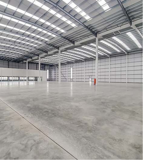
Operational efficiency
Accurate, verified as-built surveys help logistics teams streamline workflows, improve space utilisation, and eliminate costly uncertainties in busy industrial environments.
Reliable data for safer facilities
Precise measurements and compliant deliverables support safer operations, better planning, and clearer decision-making across warehouses, distribution centres, and production sites.
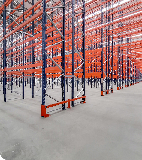
Optimised space and capacity
With clear insight into real-world layouts, operators can plan racking, equipment, and process routes effectively, maximising throughput and long-term asset performance.
The trusted surveying partner for the industrial and logistics sector
COMPLAINT. guaranteed. verified.
We're a global team of industry leading specialists in surveying, architecture, technology and International Property Measurement Standards.

We have digitised over
150,000 buildings
350 million sqft
350 million sqft
Real estate under digital management
$500+ billion
View an example project
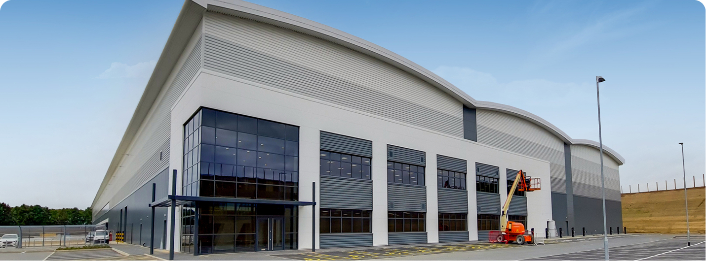
Ascent Logistics Park, UK
The technology and operating model provides a welcome injection of speed to the process of accurately mapping commercial spaces. It enables a huge time saving, particularly when dealing with large sites
Delivered foR FIRETHORN TRUST


REQUIREMENTS AND DELIVERABLES.
- Firethorn Trust is a leading investor, developer and asset manager. DRC captures and digitises their industrial and logistics spaces across the UK
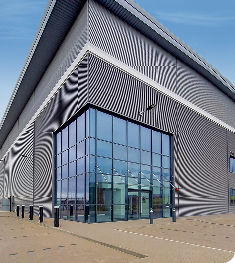
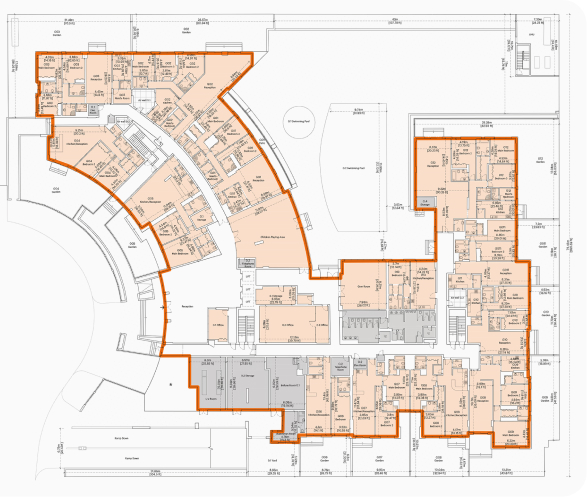
- Measured Building Survey, plus general arrangement, site information drawing, lease plans and digital brochure pages
- Scan-to-CAD with inclusive of floor plans, sections & elevations, with extremely detailed and specific sectional requirements
- All spatial data accessible securely via Stak Hub online platform
- Total GIA over 2.4 million square feet
- Asset class: Industrial
Speak to our team for further details
Explore the services we provide
Verified. ACCURATE. EFFICIENT.
With rich, accurate 3D datasets and ground breaking end-to-end technology, DRC delivers a wide-range of industry leading assets.
Measured Building Survey
Delivering accuracy you can trust, we create a single verified dataset that helps you understand and showcase your property with confidence.
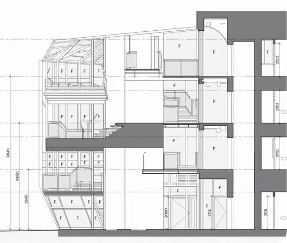
Scan-to-CAD
We transform 3D scans into detailed 2D CAD drawings, delivering accurate floor plans, sections, and elevations derived from verified point cloud data.
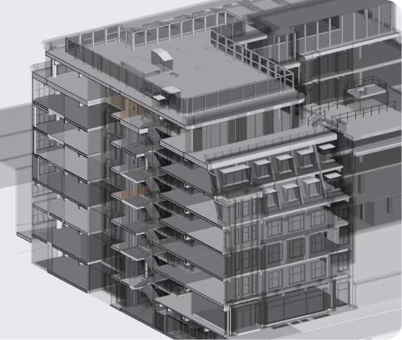
Scan-to-BIM
Using advanced laser scanning and BIM technology, we create high-accuracy 3D models with full architectural, structural, and MEP detail.
UAE Surveying Services
We are an approved third-party surveyor, specialising in off-plan (Oqood, as-planned) and completion (title deed, as-built) surveys.