Architects and Project Managers
DEVELOPMENT. DESIGN. AUDITS.
Providing precise, foundational data for accurate design and planning, reducing errors and costs.

Property Owners
OPTIMISED OPERATIONAL EFFICIENCY.
See where space can be optimised, and act on what matters.

Developers
MAXIMISE VALUE ACROSS FULL ASSET LIFECYCLE.
Build with confidence, from planning to final sign-off.

Asset and Property Managers
MAXIMISE VALUE ACROSS FULL ASSET LIFECYCLE.
Insured and underwritten spatial data so you can deliver effective property management with confidence.

Facilities Managers
SEAMLESS ACCESS TO DIGITAL TWINS.
Stay ahead of safety, compliance and efficiency challenges.

Why it matters
Confidence in accuracy
Every survey follows strict RICS guidelines, ensuring you work from reliable data.
Smarter decisions
Verified assets streamline everything from property management to leasing and renovations.
Market-ready visuals
Showcase your property with professional photos and immersive tours that engage tenants, buyers, and investors.
Through Stak Hub, explore and manage your spatial data effortlessly.
Stak Hub brings all your verified spatial data together in one secure, intuitive platform. Access floor plans, CAD, BIM, photography and digital twins instantly — all produced through DRC’s proprietary technology. With every asset structured, standardised and easy to navigate, you gain complete visibility and control across your portfolio.
Explore the services we provide
Verified. ACCURATE. EFFICIENT.
With rich, accurate 3D datasets and ground breaking end-to-end technology, Stak delivers a wide-range of industry leading assets.
Measured Building Survey
Delivering accuracy you can trust, we create a single verified dataset that helps you understand and showcase your property with confidence.
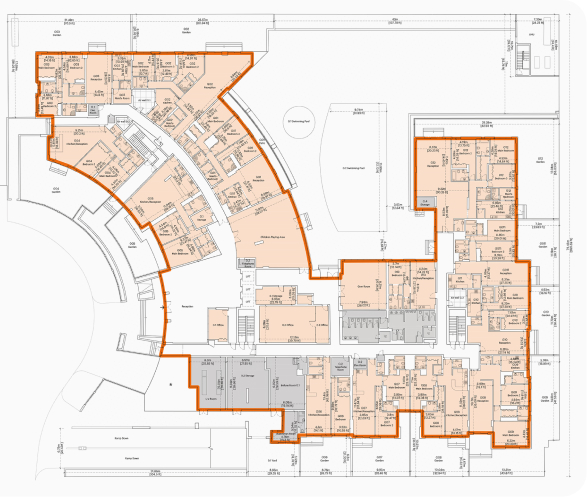
Scan-to-CAD
We transform 3D scans into detailed 2D CAD drawings, delivering accurate floor plans, sections, and elevations derived from verified point cloud data.
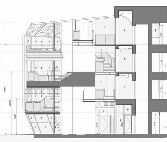
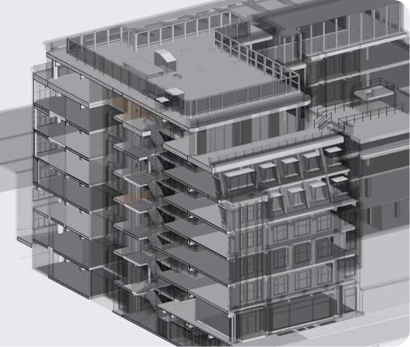
Scan-to-BIM
Using advanced laser scanning and BIM technology, we create high-accuracy 3D models with full architectural, structural, and MEP detail.
UAE Surveying Services
We are an approved third-party surveyor, specialising in off-plan (Oqood, as-planned) and completion (title deed, as-built) surveys.

We’ve digitised 180,000+ spaces, totalling
390+ million square feet