Unlock portfolio-wide intelligence with accurate,
consistent spatial data
A single, verified source of truth improves decision-making, reduces discrepancies, and streamlines portfolio operations.

0%
cost saving with project
issues found and fixed faster
issues found and fixed faster
Real value for all stakeholders
ROI AND BENEFITS.
Asset and property managers rely on DRC for a complete, verified picture of their portfolios. Our RICS-compliant as-built data provides precise floor-plans, BIM models, imagery, and spatial insight, all captured accurately and consolidated into one trusted dataset. With reliable information at your fingertips, you can manage leases, assess risk, support valuations, streamline maintenance planning, and coordinate refurbishments without uncertainty. This means fewer site visits, faster approvals, and the clarity to operate and optimise your assets with long-term confidence.
- Space usage analysis
- Portfolio-wide optimisation
- Stakeholder engagement
- Reducing site visits and consultancy costs
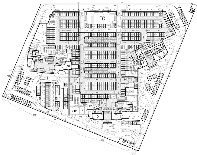
USING OUR MEASURED BUILDING SURVEY
- Assess general arrangement and areas for design opportunities
- Visual source of reference
USING ADDITIONAL ASSETS
- Assess portfolio area usage to ensure optimisation
- Facilitates dilapidations condition report
- Identify all buildings within ownership
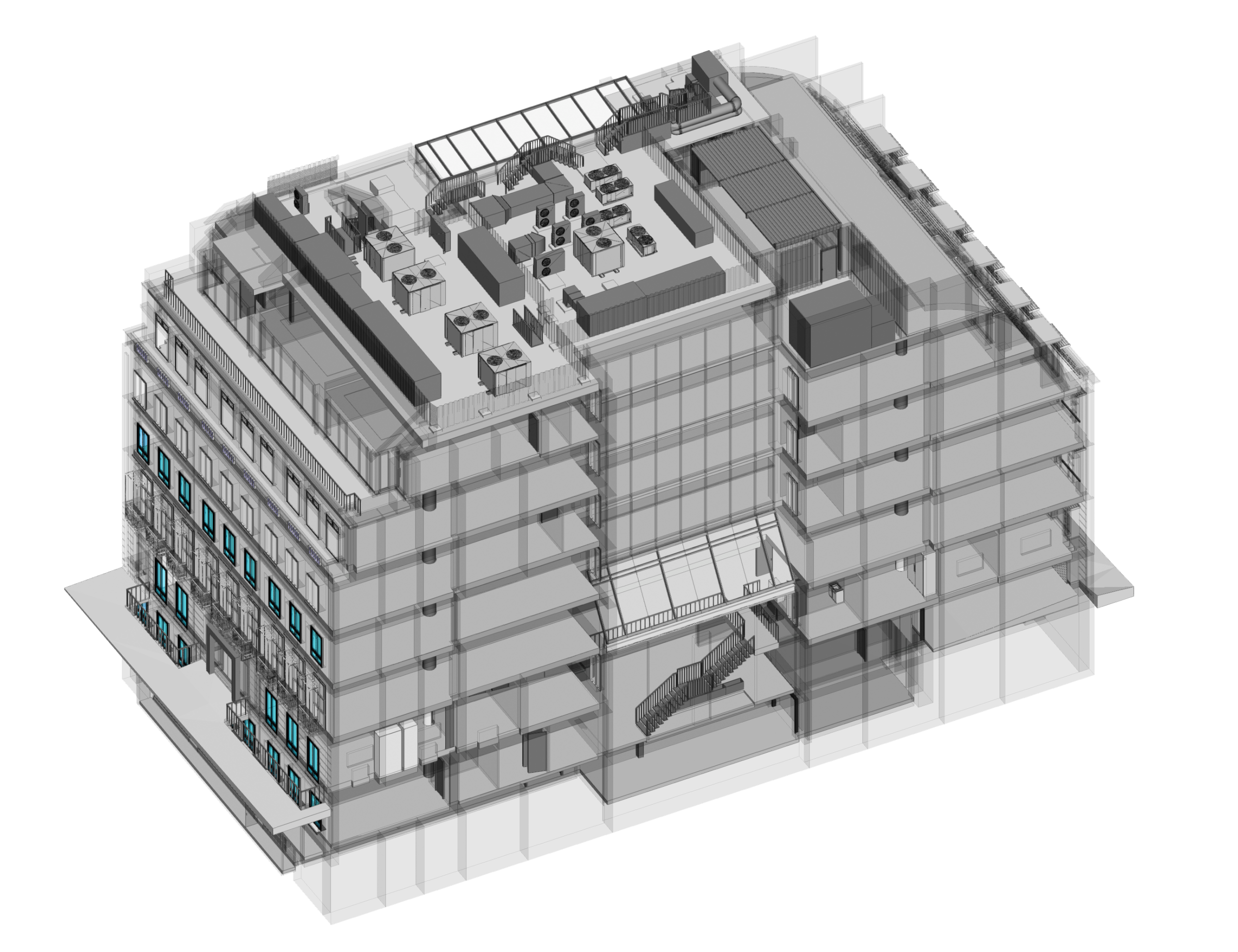
USING SCAN-TO-BIM
- Review potential opportunities within the portfolio
- Review and analyse assets virtually, reducing physical inspections
- Immediate desktop analysis, increasing speed and reducing cost
- Assistance to help desk to facilitate identification of issues

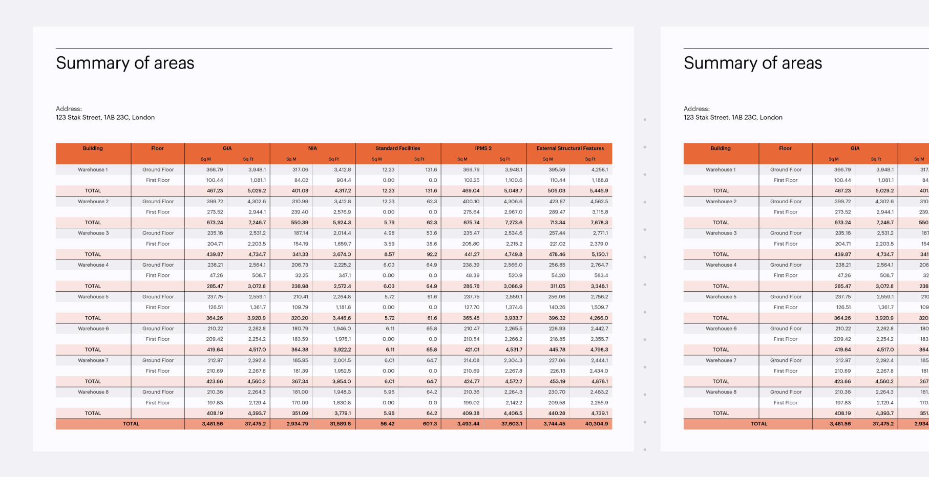
Verified area measurement reports
stak hub
Need a quote for your building or portfolio?
See how we can support you, explore Stak Hub today.
explore stak hub
SCAN-TO-CAD
SCAN-TO-BIM
360° Virtual tour
PROFESSIONAL PHOTOGRAPHY

Why it matters
Dependable data for every decision
Accurate as-built information empowers owners and developers to evaluate sites, plan upgrades, and coordinate teams with confidence from the very beginning.
Fewer risks, smoother progress
Verified surveys reduce uncertainty, eliminate measurement errors, and help prevent costly delays, keeping projects moving without disruption.
Future-ready digital records
From CAD to BIM to imagery, consolidated digital assets support long-term planning, compliance, and portfolio-wide consistency.
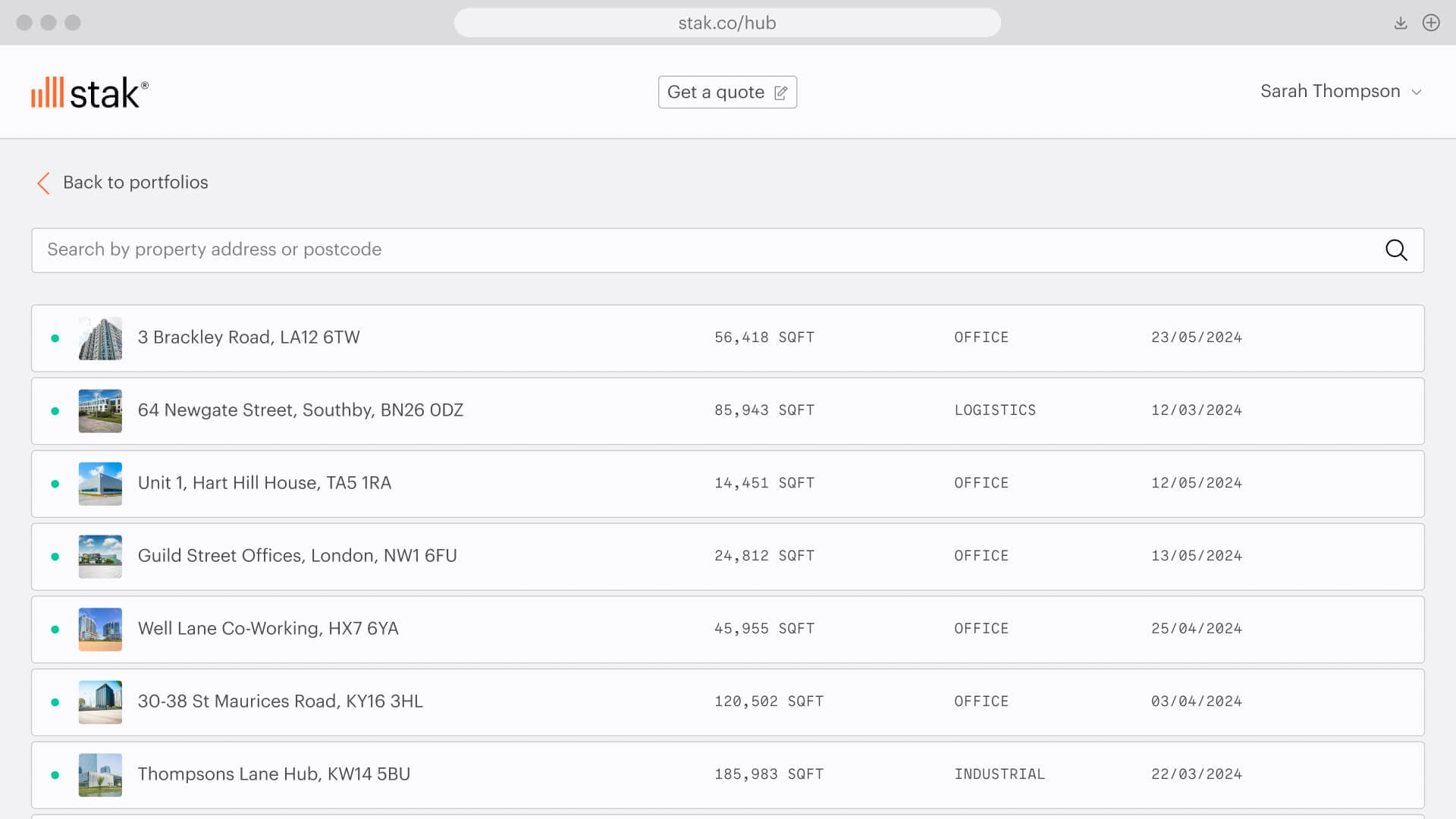
Stak Hub, our easy to use
online client platform
Explore and manage your spatial data effortlessly.
- Access verified and insured spatial data of your buildings
- Secured central hub for all your buildings
- Online access to enable realtime decisions from anywhere in the world
- Can be organised on a portfolio level
- User access control within your organisation
- Private links to assets for exclusive access
Cut down site visits, uncover hidden opportunities, and get a clear view across your entire estate, all from one consistent source of verified spatial data.
We've digitised 180,000+ spaces, totaling
390+ million square feet